Forgotten Coney Island: A Post Hurricane Sandy Tour
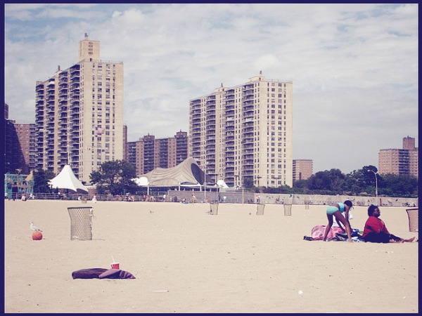
NEW YORK — On Neptune Avenue in Coney Island, state Sen. Diane Savino and a group of community activists walked a cracked and broken sidewalk on a recent day this summer — taking a tour of damage that remains nearly a year after Hurricane Sandy pummeled some of the city’s notable coastal neighborhoods.
At one point, the group stopped to look past a contorted chain-link fence at a massive sinkhole filled with bags of trash, milk cartons and diapers. The crevasse yawned with fault lines that zigged and zagged onto the sidewalk and towards the street. It looked to be growing.
“That thing goes down a ways,” said Ken Jones, a longtime community activist, referring to the sinkhole. “It’s probably right under the sidewalk.” The fact that it has apparently been used on more than one occasion as a dump only added to the activists’ concern that no one — not the state, not the city — is paying enough attention to their neighborhood.
Only a few blocks down from the amusement district, where the sounds of the frolicking beachgoers and carnival games have come back with renewed vigor after the neighborhood's near-cataclysmic meeting with the superstorm, there is a different Coney Island that most tourists and beach goers don’t see.
This is the Coney Island that continues to struggle to return to normalcy. The Coney Island where parks and playgrounds remain fenced off because of sinkholes or other damage done by last year’s storm. The Coney Island where public housing tended by the New York City Housing Authority is wrapped in scaffolding and chain link fence; and where the library won’t reopen until October. The Coney Island where the local hospital isn’t operating at full capacity and where temporary structures containing furnaces and other critical infrastructure are still in full use.
“They say Coney Island is open for business. Sure, the entertainment district is, but no one talks about the parts of Coney Island where people actually live. They don’t talk about the neighborhoods,” said Ed Cosme, a resident who formed The People’s Coalition of Coney Island to raise awareness about the problems in the parts of the neighborhood that don’t normally draw tourists and bathers.
It’s there, in those neighborhoods, that advocates on the July 8 tour of Coney Island said residents continued to struggle with the impact of the hurricane.
“We’ve got a bookmobile a few times a week instead of a library,” Jones said. “We got a mobile clinic instead of a hospital. This isn’t cutting it.” He carried in his hands a binder full of pictures of every sinkhole he has spotted — over a dozen — as well as fenced off playgrounds. He wanted the group to see as many of these spots as possible.
Some relief for the neighborhood could be at hand. Coney Island is eligible to receive over $6 million through the state’s “Storm Communities” plan announced by Gov. Andrew Cuomo on July 18. The program aims to address damage leftover from the hurricane that washed through the region on Oct. 29, 2012.
In the meantime, advocates say they are trying to draw attention to the needs of the community.
Councilman Domenic Recchia, whose district includes Coney Island, said he has been in contact with multiple city agencies that are working together to study the sinkhole problem in particular.
“They are trying to find out why we are having this problem,” Recchia said. “It isn’t clear if the earth is moving or the sand got pushed out from under the pavement by the flood. But I know it is a problem for a lot of people. They are getting them in their driveway or backyards. I get calls about it all the time.”
The Bloomberg administration’s recent report on the impacts of Sandy described how the area that is now Coney Island was developed from an island and a series of wetlands into the mostly-paved area we know today.
“The peninsula that now contains Coney Island and three other Southern Brooklyn neighborhoods was once an actual island,separated from the mainland by Coney Island Creek and reachable only at low tide,” the report said. “The entire area was a collection of wetlands, tidal marshlands, bays, inlets, creeks, and barrier islands — first the fishing grounds of the Lenape people and then part of a quiet farming community.”
The report goes on to describe how, during Hurricane Sandy, flood waters reached up to 10 feet in places like Neptune Avenue. Perhaps most striking is how drastically Sandy altered Coney Island’s beaches: The storm is credited with moving 272,000 cubic yards of sand. “At Ocean Parkway, for instance, waves pushed thousands of tons of sand northward, with water traveling 1.5 miles north to Avenue W, joining floodwaters from Sheepshead Bay and Coney Island Creek,” the report read.
Advocates and politicians alike speculate that flooding from Sandy also moved the sand and earth under the pavement, resulting in the sinkholes they see around western Coney Island.
Representatives for both the Department of Transportation and the Department of Environmental Protection said they have not received many complaints about potholes or sinkholes in western Coney Island.
DEP spokesman Christopher Gilbride said that sinkholes were a problem immediately after the storm because of broken water lines but he said there haven’t been problems reported since then. He noted that sinkholes are either caused by a broken water main or through erosion of dirt or sand under roads — which is exactly what advocates say they are concerned about.
Savino’s office said they have made repeated calls about potholes, sinkholes — or whatever you want to call them — and some of the holes have been patched with asphalt only to reopen bigger than before. Savino’s office is working with Jones and Recchia’s office to compile a master list of all the holes around western Coney Island and to present it to the DOT and DEP.
But it isn’t just the sinkholes that have residents concerned that their part of Coney Island is being ignored. Looking past the massive sinkhole on Neptune Avenue, the tortured skeleton of a wooden dock uprooted and smashed by Hurricane Sandy could be seen. A number of boats remained lifted out of the water, stranded on rocks, water-damaged and rotting. “No one has claimed them yet?” Savino asked rhetorically.
The owners are likely long gone. Just like the proprietors of the closed Chinese food restaurant and bodega across the street. “They were just hanging on before Sandy,” Savino said. “They were already in debt. After that storm, another loan wasn’t going to save them.”
Aida Leon is the executive director of the Amethyst Women’s Project, a group that helps women struggling with substance abuse, domestic violence and HIV/AIDS.
As the tour of Coney Island progressed, she said she was concerned that established charitable organizations had been ignored by the larger groups that came in with funding to address problems caused by Sandy.
“They haven’t been on the ground like we have,” she said. “We lost a lot of people after Sandy. They didn’t come back to the programs and I don’t think they are coming back because the people with funding don’t know how to reach them.”
As the group of community advocates led by Savino continued their tour around Neptune, Mermaid and Surf avenues, it became clear that life for most residents here is far from normal.
Housing Authority properties like the 597-unit Surfside Gardens and 573-unit O’Dwyer Gardens were surrounded in metal fencing and scaffolding, each individual playground and park on the properties sealed off by chain-link fencing. Only a cursory glance revealed the likely reason: more sinkholes erupting underneath concrete at the bottom of slides, near merry-go-rounds and other playground equipment. Programs for children and seniors have been cancelled.
Jones insisted Savino see the sinkholes. He squeezed behind fences and lifted plywood that covered craters. “Look at this. This isn’t safe,” he says. “Where are the kids gonna play?” Jones noted that he lost a tire to a deep pothole, and has been documenting them since that episode.
A resident of the apartment complex walked by, suspiciously peering at the group. “What is they here for?,” she wondered out loud. “Maybe they looking for them rats,” she answered herself.
NYCHA said in a statement that sinkhole repairs were “currently underway” at developments affected by Sandy, including in Coney Island. “NYCHA is beginning the process to complete the work for the play areas at various affected developments in the area,” the agency said.
Recchia said some programs for children were functioning. “We have summer programs like the Cornerstone program and others out of Kaiser Park. They may not all be open but there are programs,” Recchia said.
Savino’s staffers said their office had fruitlessly contacted NYCHA about playgrounds being closed and the scaffolding that surrounded the buildings and blocked windows. A recent report by Comptroller Bill de Blasio has highlighted the backlog of thousands of repairs dating back years that NYCHA has yet to address.
But Recchia was quick to defend the city’s response — taking responsibility for the fact that public housing was still under construction and that the library wouldn’t open until October.
“I’ve said from the start that we are not going to rush but address the long-lasting problems,” Recchia said. “The reason the library isn't open is because I want things done the right way.”
Recchia said his approach to addressing the problems left behind by Sandy was informed by a Council trip to Louisiana.
“The one thing they said they did wrong was that they rushed to get things back as quickly as possible,” Recchia said. “But now they need to fix them again because no one addressed the core problems.”
Savino is familiar with the damage Sandy wrought across the city. She served on the Senate’s Bipartisan Task Force on Hurricane Sandy and toured not only the boroughs that were impacted but Long Island as well. Her district office in Coney Island wasn’t spared Sandy’s wrath: Her staffers described how flooding rose nearly five feet up to a poster of Savino on the wall, destroying furniture and tossing a heavy air conditioner. The office reopened this spring.
The same couldn’t be said for Liberation Diploma Plus, a school that was the next stop on the tour and serves students in grades 9 through 12. Only three blocks from the beach, the school was ravaged by flooding.
April Leong, principal of Liberation, described for the group how the flooding destroyed everything on the first floor — books, supplies, desks, the kitchen, gym floors. The second floor also suffered.
The Department of Education leases the property and as a result the owner had to apply for federal recovery funds. Leong said she worked sometimes 18-hour days to get the school cleaned up.
The process took longer than it might have, but once repairs were finally initiated they were made quickly — too quickly. Water warped boards were left in place and new boards installed on top. As the group of activists stopped by, Leong was busy overseeing the second round of repairs.
Leong spent the early days of the storm struggling to get her students registered so that she wouldn’t lose funding from the DOE — she succeeded but still lost funding. Liberation is a transfer school for a students from around the city who have struggled in regular classrooms so finding all the students after Sandy was not easy. “These are kids that people already gave up on,” Leong said, stressing the importance of bringing Liberation back to life.
She took the group through the muggy first floor, into the cooler cafeteria where a few students sat and sipped juice.
Savino sat down at a lunch table, fanning herself from the heat. “This woman is single-handedly keeping this place afloat and it means so much to these kids and the community,” shes said, motioning to Leong.
Savino said a number of residents and issues have slipped through the cracks because of confusion over programs.
“The state and city seem to be working at cross purposes on a lot of stuff,” Savino said.
In announcing a home buyout program for areas that were in the dangerous flood zone, Gov. Andrew Cuomo told New Yorkers who lived next to the shore that “there are some parcels that Mother Nature owns. She may only visit once every few years. But she owns the parcel and when she comes to visit, she visits.” Mayor Michael Bloomberg offered the opposite tactic: a plan to strengthen existing coastal communities while continuing to build smart around the coastline.
Savino noted that a number of homeowners have not requested help. She said she believes it is because they are undocumented immigrants from China who bought their homes with cash and are afraid to seek help from the government.
And both Savino and Recchia acknowledged they were at a loss at what to do about the small businesses that have left. “People are worried about taking the risk on Coney Island,” Savino said.
Recchia said that things aren’t back to normal, that life isn’t easy for all those living in Coney Island. But he said the neighborhood was on the road to recovery. “Compared to other parts of the city, I think we're doing pretty good,” he said. “Take a look at the NYCHA facilities — they are working on them. It’s not like the work isn't happening.”
After two hours of walking in the heat, the group members said their goodbyes. But Jones had a shocker for Savino. He said he was thinking about moving to New Jersey. “You can’t go to Jersey!” Savino said. “You are Mr. Coney Island. You can’t leave.”
Jones hung his head for a second and looked up, smiling. “This is getting to be too much for me,” he said. “I’m too old for this.”
No Retreat From The Coastline
NEW YORK — Striking a tone of defiance, Mayor Michael Bloomberg said today that New York City will not retreat from its coastline despite the threat of rising sea levels and the possibility of storms more catastrophic than Hurricane Sandy.
On the contrary, he argued, the city should not only continue to build along the waterfront but build better.
“As New Yorkers, we cannot and will not abandon our waterfront. It’s one of our greatest assets. We must protect it, not retreat from it,” the mayor said at the unveiling of a voluminous report detailing the city’s assessment of the impact of Superstorm Sandy and the risks posed by climate change.
The report itself states that, prior to Sandy, the city had made significant strides in preparing for climate change.
“Our resiliency investments performed well during Sandy,” the authors write. “But Sandy’s magnitude, its effects on so many parts of the city, and the threat of even greater risks from climate change also taught a second lesson: we needed to redouble our efforts.”
From sand dunes to temporary flood barriers to funding for building system upgrades, the plan unveiled by the mayor aspires to fortify the city — at an estimated cost of $19.5 billion — in the face of a rapidly changing environment rather than pull back development from the waterfront.
It is also ambitious, asserting that a large, new residential and office development project off the tip of Lower Manhattan and similar to Battery Park City, was not only realistic but necessary.
The report released today, "A Stronger More Resilient New York," is part of the city’s ongoing and far-reaching sustainability initiative, PlaNYC.
The risks posed to New York City are daunting. Underpinning the conclusions of the report is new data generated by the city’s Panel on Climate Change, also released today. The panel projects that “by mid-century, sea levels could rise by more than 2.5 feet, especially if the polar ice sheets melt at a more rapid rate than previously anticipated. That magnitude of sea level rise would threaten low-lying communities in New York with regular and highly disruptive tidal flooding.”
The Panel also projects that average temperatures in the city could rise as much as 6.5 degrees Fahrenheit by the 2050’s, while precipitation could increase by fifteen percent. As a result, both the number of annual heat waves and days with intense precipitation — rainfall in excess of 2 inches — will increase steadily.
By that point, the mayor said in his speech, “up to one-quarter of all of New York City’s land area, where 800,000 residents live today, will be in the floodplain.” Precisely because so much of the city is now threatened by rising sea levels, retreating is not considered an option, he argued.
RELATED: JOIN THE CONVERSATION SURROUNDING CLIMATE CHANGE AT ADAPTNY
The mayor noted some 270,000 jobs are now in areas within the federal government’s 100-year flood maps.
“They are not going anywhere, and we cannot and will not abandon them,” Bloomberg said. Instead, the city’s response, as detailed in the report, is to aggressively and pro-actively construct “layers of defense.”
One layer would consist of off-shore barriers like breakwaters and wetlands that would help to blunt the force of powerful storm surges.
Another layer is what the mayor described as “a strong line of coastal defense,” which would rely on reinforced dunes and widened beaches, levees, floodwalls, bulkheads, tide gates, and surge barriers. The mayor noted that constructing a massive barrier across New York Harbor — one idea being floated — was impractical. But smaller “localized” surge barriers, he argued, could make a big difference.
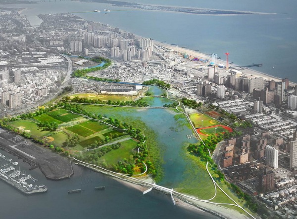
Many of the surge and tidal barriers now being proposed by the city are intended to address “back-door” flooding, when a storm surge pushes floodwater into rivers, creeks and canals. The city is looking at possible barriers in several locations, including the mouth of Jamaica Bay, Newtown Creek, the Gowanus Canal, and Coney Island Creek.
The report includes 37 proposed coastal defense projects, some of which are already underway, such as beach and dune restoration projects on Staten Island, Coney Island and along the Rockaways. The city said construction of flooding and erosion barriers on the South shore of Staten Island has also begun.
Other layers of defense include green infrastructure, like permeable pavement surfaces, which can absorb floodwater or channel it into “higher capacity” sewers.
An especially critical layer is the city’s building stock. The Bloomberg administration is proposing a $1.2 billion incentive program – in conjunction with HUD – to assist property owners in vulnerable areas with flood-proofing their heating, electrical and other building systems.
The report also examines how to protect and upgrade local utility, telecommunications and fuel supply networks in light of climate change and its impacts. The mayor noted that two-thirds of major substations and nearly all of the city’s power plants are situated in floodplains.
Measures to safeguard critical infrastructure, such as hospitals and other health care facilities, along with the city’s transportation network, parks, water, wastewater and solid waste systems, are outlined as well.
The mayor said that more than $100 million of the $1.77 billion in federal relief funding that had been allocated to New York City would be diverted to public housing for upgrades. The city’s Housing Authority is also slated to receive funds from the Federal Emergency Management Administration. Four-hundred NYCHA buildings — housing 80,000 residents — were damaged during Sandy. Several NYCHA developments are located in coastal areas.
Building in flood-prone areas can be done safely, argued the mayor. “We’ve proposed new zoning that makes it easier to elevate existing buildings above the floodplain,” he said. The city will also be making changes to its construction codes that it said will raise standards for new buildings.
The mayor argued that waterfront development does not have to be deterred by rising sea levels. Referring to Lower Manhattan’s need for housing and office space, the mayor proposed a new waterfront development similar to Battery Park City called “Seaport City” that would be constructed on the East Side. The development would potentially house “thousands of new residents and hundreds of businesses.”
The mayor asserted that Battery Park City was specifically designed to withstand major flooding and for the most part did so. He described Seaport City as an “ambitious idea” and added that the new development had the potential to protect “existing residents and businesses from future storms.”
“Yes, it would be expensive to build. But over time it could prove to be a great investment,” he said.
When asked if the administration believed that any areas of the city would eventually have to be abandoned due to sea level rise, Economic Development Corporation President Seth Pinsky said that “building on the coast is not a problem.” Pinsky, who led the team that created the city’s new report, added that construction had to happen at “the right elevation.” The city’s confidence that it can retain use of its entire coastline is not shared by all climate experts.
Klaus Jacob, a member of the city’s Panel on Climate Change and a geophysicist with the Columbia University Lamont-Doherty Earth Observatory, told the Gotham Gazette in January that it was necessary to think beyond the next few decades. By the end of the century, he maintained, sea level could rise by 6 feet, making parts of the city uninhabitable.
“Sea level rise is the ultimate fate of the city,” he told the Gazette. “It truly threatens the livelihood of the city as we have it now — unless it adapts. It can adapt. It can be a totally lively city without barriers. We are lucky. We have high ground within our boundaries. Neither New Orleans nor Amsterdam nor Venice have that luxury. We have that luxury. We just have to move together on higher ground.”
The city estimates that the initiatives and projects it proposes within "A Stronger, More Resilient New York" will cost $19.5 billion. The mayor said that $10 billion was covered by existing city capital dollars and federal funds. Another $5 billion would be available from FEMA and future rounds of federal Sandy relief dollars that have been appropriated by Congress.
City officials said they will press the federal government for the remaining $4.5 billion.
Regulators Seek Answers About Rockaway Pipeline Project
NEW YORK — Regulators are aggressively seeking answers about potential environmental risks to the Rockaway pipeline project, including whether flooding caused by future extreme storms could damage critical infrastructure.
Both the state’s Division of Coastal Resources and the Federal Energy Regulatory Commission are seeking answers from Oklahoma-based Williams Cos., whose subsidiary, Transco, is building part of the complex project.
In particular, they want to know how flooding from category 3 to 5 storms could affect a natural gas metering station planned for Floyd Bennett Field in southeast Brooklyn.
After receiving what it described as an incomplete response to its question about potential flooding caused by extreme weather, FERC said yesterday that it wanted a fuller response within 10 days.
“Transco’s response to the [state] does not provide an assessment of impacts,” FERC said. The agency said it was seeking information about measures that would be taken to address flooding associated with the "potential increase in the frequency and intensity" of major storms "due to climate change sea level rise."
The state has also requested information from Transco regarding potential risks to the Rockaway pipeline, generally, from catastrophic storms.
Williams operates the 10,000-mile Transco natural gas pipeline, which runs parallel to the Rockaway coast. Plans call for building a 2.79-mile feeder line from the Transco pipeline, along the ocean floor toward Jacob Riis Park, and then underneath it, delivering gas to new mains below Jamaica Bay. National Grid is constructing the new mains.
Transco responded in documents filed last week that it did not expect that the natural gas metering station at the park “would be subject to a flood risk of greater than one percent a year (i.e., a 100-year flood) following a one-foot increase in sea level.”
The Rockaway pipeline project consists of several interdependent parts being built by different companies, under the regulatory scrutiny of multiple levels of government. Half of the project — managed by National Grid — has already been approved and is underway. The other half — managed by Williams Cos. — is undergoing a lengthy federal review process which offers opportunities for public comment.
The project’s very complexity has fueled confusion about its potential environmental impact and led community leaders and local elected officials to question its safety.
The first phase of construction on the Rockaway pipeline project began in March. National Grid is constructing two gas pipelines — 1.6 miles in length and 50 feet below seabed — underneath Jamaica Bay’s Rockaway Inlet.
According to company spokeswoman Karen Young, the utility is now drilling underneath the Bay to accommodate the first of the two pipelines.
“Welding of the 1.6 miles of the 26-inch pipeline is almost complete,” she said. “Once the drilling is complete, the pipeline will be installed underneath the Rockaway Inlet and the same process will begin for the 12 inch pipeline.”
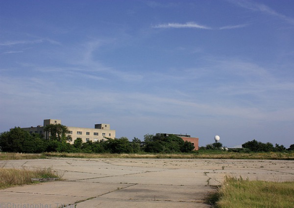
National Grid will later connect these cross-Bay lines to customers in Brooklyn and Queens via the gas meter and regulating station that will be housed within a historic hangar at Floyd Bennett Field. Gas entering the meter station will eventually link to an existing gas main on Flatbush Avenue.
National Grid’s new delivery capacity will be supported by the off-shore feeder pipeline to be constructed by Williams.
The National Grid portion of the Rockaway pipeline project was reviewed under the New York City “Environmental Quality Review Act.” In December 2011, the city found that the project “would not have an adverse impact on the environment.” Because of this, the project did not require a public review process or full-scale environmental review. The Bloomberg administration has been a supporter of the project.
Williams’ off-shore pipeline, meter station, and capacity increase proposals, however, must work their way through the federal environmental review process. This will be followed by a public commenting period on the draft environmental impact statement.
Much of the construction on the Rockaway pipeline will take place in Gateway National Recreation Area, a 26,000 acre National Park, which includes ocean-facing Jacob Riis Park and the Jamaica Bay Wildlife Refuge.
The project also continues to expand and change over time, adding to the complexity surrounding it.
For instance, Transco is now proposing an increase of 100,000 dekatherms in the amount of natural gas the pipeline will deliver each day to the New York City area. The Rockaway project was originally slated to deliver a daily total of 647,000 dekatherms, approximately 625 million cubic feet of gas. The proposed capacity increase will be facilitated by upgrading gas compressor stations in Pennsylvania and New Jersey.
In documents filed with FERC on May 6, Transco said they also now intend to construct an additional, eight-inch pipeline between the meter station at Floyd Bennett Field and Flatbush Avenue “at the request of National Grid.”
Besides preparations for flooding caused by extreme weather, regulators have posed a series of additional questions about seven-year intervals between pipeline inspections; whether alternative drilling methods would be less disruptive to marine life; and a proposed off-shore pit that would contain used drilling fluid.
Transco responded last week that the seven-year inspection schedule followed federal regulations; and that it would monitor the impact of the pipeline's operations on marine life. The company has not yet released requested information about how it would handle accidental releases of drilling fluid off the Rockaway coast, or alternative ways to dispose of used drilling fluid and cuttings.
Project documents estimate that construction of the off-shore section of the pipeline will disturb a 30-acre area, displacing 157,600 cubic yards of material.

