A Seafaring Commute
City Council Speaker Christine Quinn endorsed the creation of a citywide ferry service and an expansion of a small business insurance program in her State of the City address last week. Now advocates and stakeholders are weighing in, and - for the most part - appear to be praising the proposals.
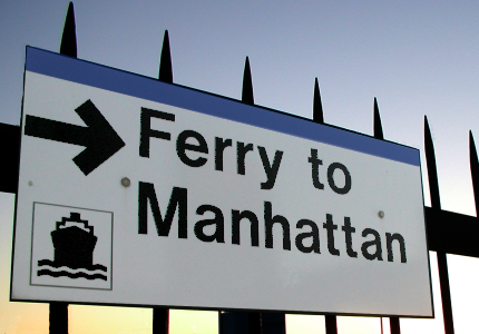
Last week, City Council Speaker Christine Quinn announced her support for a five-borough, year-round ferry system that Mayor Bloomberg and the city Department of Transportation are developing. Such a proposal may seem like a pipe dream to many New Yorkers, who have seen ferry service remain fairly stagnant, either from a shortage of funding or an apparent lack of demand.
But the next time you are heading between waterfront neighborhoods like Astoria, Queens and Red Hook, Brooklyn, just imagine how much nicer the trip could be on a ferry. Rather than fuming at the scarcity of G trains, envision yourself on the ferry’s top deck as you are whisked down the East River and the Manhattan skyline floats by.
A comprehensive ferry system would not only give us a better view, it would turn waterway commuting into a viable and appealing form of public transportation. If done right, a ferry system could be affordable, environmentally conscious and ease the mounting pressure on our rickety transit system.
Transit for a Coastal City
The Big Apple has had a long and complicated relationship with ferries. Gone are the days when steamers plied the waters between Manhattan and Rockaway several times a day with more than 3,000 passengers aboard. With notable exceptions like the Staten Island Ferry, waterfront commuting has gradually gone the way of the dodo. That’s because service is infrequent, fares tend to be relatively high and political support has been soft. Because of their high capacity, subways get most of the attention these days – New York City Transit just recorded its highest annual subway ridership in more than a half-century, with 1.56 billion rides in 2007.
But while the subway network hasn’t expanded in decades, the Big Apple certainly has. Neighborhoods that were once home only to industry are now coveted addresses – the only problem being that there is no subway to serve the new residents. And as anyone who has been on the subway recently knows, the trains are crowded. Congestion pricing is a great start, since it will help us pay for new buses and trains and help clean the air. But congestion pricing alone won’t solve all our transit woes, so we must explore complementary options.
Ferries have a number of advantages over other modes of mass transit. New York City is surrounded by water, and our waterways and waterfronts are, in many cases, untapped resources. Because they rely on the water to move passengers, ferries require very little infrastructure to set up compared with multi-billion dollar subway tunnels. Ferries are also flexible enough to keep up with changing population trends and would help commuters leapfrog all those local subway stops if they are going between boroughs outside Manhattan. There’s also a local economic benefit, as shops, restaurants and services would sprout near ferry terminals.
Getting Onboard
The first step should be to implement service where the need is greatest. That means in far-flung areas that have been clamoring for ferries for years. It seems barely a month goes by in Howard Beach or Broad Channel when the topic isn’t brought up at civic association meetings. Even as you are reading this, the Sunset-Ridge Waterfront Alliance is collecting signatures online for a petition to reinstate service at the 69th St. Veteran's Memorial Pier in Bay Ridge.
There is a compelling economic argument in favor of ferry service to these communities. Far Rockaway, for example, is one of the poorest areas in New York City, and its distance from the central business district of Manhattan has clearly contributed to its economic isolation -- the average commute time to Manhattan is well over one hour. The Economic Development Corporation is now reviewing bids from private ferry operators to start a two-year pilot program to lower Manhattan. The timetable isn’t clear yet, but, at a minimum, service would be provided Monday through Friday during peak rush hours.
Navigating the Obstacles
Ferries will in all likelihood require some level of government support – as our buses, subways and commuter trains all do. The price of a ticket must also be fair. In addition, a viable ferry system must include sensible connections to make the door-to-door commute a desirable one.
In too many instances, getting to and from the ferry itself is not a pleasant experience. For example, a number of large employers are located near the 34th Street dock in Manhattan, but getting to them from the water is a hassle, requiring commuters to cross the FDR Drive and another lane of cars. To reach the Hunters Point ferry terminal in Long Island City, pedestrians must use haphazard walkways and pass through an active parking lot. For commuters coming off the subways or buses in Long Island City, the shortest walking distance to the dock is 10 blocks.
We must also make sure the ferry system is environmentally sound. Energy-efficient, clean fuel vessels are essential to reducing air pollution and greenhouse gas emissions. Fortunately, clean-fuel watercraft is off in the future; solar-powered ferries, for example, already are in place in several cities around the world. If the new ferries are owned or operated by the city, they would also be required to use ultra low-sulfur fuel under legislation the City Council passed last week.
With New York City expected to grow to 9 million residents by the year 2030, ferries will also advance the discussion about how to create more transit-oriented development. Neighborhoods like Red Hook and Williamsburg are growing at a rapid clip yet have limited access to the subways. If we pair future communities with ferry service, we can ensure that our waterfront areas are models of 21st century design, urban planning and sustainability.
Marcia Bystryn is the executive director of the New York League of Conservation Voters. Â
Helping Old New Yorkers Get Around Town
Segundo Musse doesn't walk too much anymore. "I got hit by a car and broke both my legs," he said surveying the scene along Manhattan Avenue in the Greenpoint section of Brooklyn. "I used to be quick on my feet. Now, I'm slow and I'm only getting slower."
Musse, age 67, is one of 1.25 million New York City residents over 60. Like many others his age, he has seen his mobility diminish over time. "If I need to go somewhere, I take the bus," he said. "It's a pain to get around, but with the senior pass it's cheap enough and it's better for me than walking or the subway."
Late last month, Mayor Michael Bloomberg announced a series of transportation improvements aimed at older New Yorkers like Musse. Bloomberg's plan, dubbed "Safe Streets for Seniors," promises traffic engineering improvements at 25 high-accident areas that are especially problematic for aging residents.
What has prompted these changes? And what will they look like?
Walk At Your Own Risk
As it is for most New Yorkers, walking is a key form of transportation for older residents. Whether one walks down the block for milk and groceries, gets to a bus or subway by foot or goes out to hail a taxi, walking is a necessary part of almost every trip in the City.
But for many older people, New York City streets are hostile turf. According to research by Transportation Alternatives, residents age 60 or over make up only 13 percent of the population, but account for more than 33 percent of all pedestrian injuries and fatalities.
Although pedestrian fatalities declined sharply in 2007, one third of the 138 pedestrians killed by cars on New York City streets were seniors. And as the elderly population grows -- the Department of City Planning predicts a 44 percent increase in residents age 65 and older by 2030 -- the need for infrastructure designed with older New Yorkers in mind becomes more pressing.
The loss of speed and agility that often accompanies old age, along with increased susceptibility to injury and fatality from falls and impacts, make seniors more vulnerable to injury and death from traffic accidents.
"The things that most people don't even have to think of, like crossing the street, some older people really struggle with. Stepping off and back on to a curb and making it across the street during a walk signal can be next to impossible," said Amy Pfeiffer, director of planning at Transportation Alternatives.
When calculating the length of a walk signal, the city transportation department uses an estimated walking speed of 4 feet per second, the speed of an average adult, to determine the length of time a pedestrian needs to cross an intersection. But many older New Yorkers move at a much slower pace.
Rachel Krug, a doctoral student at the Mailman School of Public Health at Columbia University and author of "Discriminatory by Design: A senior citizen focused study of streets and intersections on New York City's Upper East Side," found that only 25.2 percent of seniors that she observed in her research walked at 4 feet per second, with many moving closer to 2.5 feet per second. So while the transportation department calculates that it would take 15 seconds to cross a 60-foot road like 23rd Street or 72nd Street in Manhattan, many older New Yorkers would need 24 seconds.
"Near Lincoln Center, I've talked to seniors whose friends have been hit and killed at certain crossings," said Pfeiffer, who has spent hundreds of hours researching older New Yorkers' transportation habits. "They now walk out of their way to cross the street. For a senior to walk a block out of the way because they don't feel safe crossing the street is a real burden."
Krug also pointed out that perceptual impairments, like bad eyesight or balance, and even some mobility aides, like walkers, canes and wheelchairs, can make some parts of trips more difficult for elderly populations.
Getting Across Safely
So what is the city doing about this?
Following the mayor's pledge to improve 25 areas that are particularly problematic for seniors, the New York City Department of Transportation released some details of their plan. Flushing, Queens, Brighton Beech in Brooklyn, New Dorp on Staten Island, Fordham in the Bronx and Manhattan's Lower East Side will receive senior-minded safety upgrades this year. Officials state that there are 20 other neighborhoods being considered for similar enhancements in the future.
The specific improvements include:
:
- Retiming traffic signals to correspond with slower walking speeds.
- Giving pedestrians several seconds of dedicated crossing time before cars can start moving and/or turning.
- Repairing and establishing pedestrian ramps to make steps on and off the curb safer and more convenient for all people, particularly those with walkers and the like.
- Installing pedestrian islands in wide streets.
- Shortening crossing distances.
- Restricting vehicle turns.
Pfeiffer said such simple modifications go a long way. "Our basic safety treatment is so simple because we wanted to do as much as possible for as little money to help make it repeatable at other locations." More dangerous intersections, though, might require additional methods, such as enlarged corners, known as bulb-outs, she said. These expanded corners shorten the crossing distance at intersections and, by narrowing the space for cars, force the vehicles to slow down.
In 73 of New York City's 2,246 census tracts, more than 30 percent of the population is age 60 or over. In 16 of them, 40 percent of the population is 60 or above. The city hopes to concentrate its improvements in areas where they are needed most.
Making Transit Accessible
But the travel needs of older New Yorkers extend beyond crossing streets. Gene Russianoff, senior staff attorney for the Straphanger's Campaign, notes older New Yorkers are challenged on public transit as well. "If we want to have mobility for older New Yorkers the transportation system has to be more senior friendly," he said. "Signs that are easier to read would be a good start. Announcements that you can understand, that's the aim of a century long quest."
Ruth Finkelstein, vice president for health policy at the New York Academy of Medicine agrees. "Using a walker and living in Brooklyn should not mean that you lose access to a job, museums, the theater or a lifetime of friends that are in Manhattan. But to get from Brooklyn to Manhattan by bus can take two and a half hours. That's prohibitively long and so we have to get serious about subway access."
Access-a-ride service that is more consistent, convenient and courteous also is needed, according to Finkelstein and Pfeiffer.
More pubic seating, to enable those walking to take a short break, would also help. "Being comfortable in your neighborhood is a primary precursor in being able to stay independent and active. If you can't get around in your neighborhood first you can't get around anywhere else," said Finkelstein.
Checking On The Changes
In the coming months, the City Council and the New York Academy of Medicine in collaboration with the Bloomberg administration will hold a series of public forums in all five boroughs as part of the "All Ages Project" and "Age-Friendly NYC." The sessions will allow the public, and older New Yorkers in particular, to weigh in on the promised improvements and help shape further recommendations.
Millions of aging New Yorkers will be watching to see if the city makes good on its promises and whether the improvements really make it easier for older New Yorkers to move around the city.
"I've seen a lot of changes," said Musse when asked about the mayor's plans. "When the city wants to do something, I know they can."
Graham Beck is the managing editor of StreetBeat, the biweekly newsletter of Transportation Alternatives and a writer. He lives in Brooklyn.
Â
Next Steps for Congestion Pricing
On January 10, the New York City Traffic Mitigation Commission released a series of alternatives to Mayor Michael Bloomberg's original congestion pricing program for the city. The commission is slated to make final recommendations to the City Council and the State Legislature by January 31. With the commission -- and New Yorkers -- at a critical moment in this important debate, what are the alternatives under consideration and what would they mean for the city?
The Background
First, for newcomers to this issue, here are the basics: Last spring, Bloomberg released his PlaNYC 2030 proposal. PlaNYC 2030 is the mayor's environmental and sustainability legacy for the future - more than 100 transportation, housing, energy, land use and environmental programs and proposals that will reduce the city's global warming pollution by 30 percent and create the infrastructure for a city that will have 1 million more residents than it does today.
A key component of PlaNYC 2030 (certainly, the one that has received the most attention and controversy) is the proposal to create a congestion-pricing program that, for the first time, would charge drivers in midtown Manhattan at peak hours. Most of the coverage of this idea has focused on the notion of charging drivers in Manhattan's central business district to reduce congestion. But here's what's equally important: The city's proposal (and the new alternatives) will raise more than $400 million a year to give straphangers more elbow room on the 7 train, cleaner seats on the Bx1 bus and more frequent service on the F train.
In July, the state legislature passed a law that set up the commission, which embarked on a eight-month mission to consider the mayor's plan, outline alternatives and, many environmentalists and others hope, give a thumbs'-up to a three-year demonstration project by March 31, 2008.
The Five Options
The commission's January 10 report is a critical piece to figuring out what's on the horizon for the administration's proposal. (For details, check out the Interim Report itself.) In a nutshell, the commission has added four alternatives to the mayor's plan. They are:
The Mayor's Plan
Vehicles entering or leaving Manhattan below 86th Street from 6 a.m. to 6 p.m. during the week would pay $8, and trucks would pay $21. Driving within the zone would cost $4 for cars, $5.50 for trucks. Vehicles paying a bridge or tunnel toll using E-Z Pass that day would pay only the difference between the toll and the congestion charge, if any. Driving on the FDR Drive and the West Side Highway would be free.
If the mayor's proposal works as planned, it would reduce the number of miles driven in the congestion pricing zone by 6.7 percent and generate $420 million a year in revenues for transit investments. On the other hand, it's a really complicated system to manage, thanks to the intra-zone charge. And despite all the pollution and traffic they generate, taxi and livery drivers would not be charged extra for the trips they make in and out of the zone all day long. Ditto, that 18-wheeler that crossed the George Washington Bridge and came down Second Avenue or Columbus Avenue en route to Midtown, since it paid $30 on the bridge already.
The Alternative Congestion Pricing Plan
This is similar to the Mayor's plan, but it has some key changes:
- The northern border of the congestion-pricing zone would be 60th Street.
- There would be no charge for private vehicles driving within the zone -- only for entering it.
- On the other hand, there would be a charge to drive on the periphery roads.
- Taxi riders within the zone would pay a $1 surcharge.
- The value of the toll offset would be capped at $8, meaning that those trucks on the George Washington Bridge would pay a $13 congestion charge if they cross 60th Street.
- Parking meter rates would go up in the zone, and residential parking tax exemptions would no longer exist in the zone.
This closely resembles a proposal offered by the Empire State Transportation Alliance, a broad coalition of business, labor, environmental and other civic organizations in the city co-chaired by the Regional Plan Association and the General Contractors Association. (Full disclosure: I'm on the alliance's steering committee.)
It would cut congestion a bit more than the mayor's proposal. More important, it would generate an additional $100 million a year to give straphangers, train commuters and bus riders some extra breathing room on their trips throughout the city. Plus, it's a heck of a lot easier to implement, thanks to the elimination of the intra-zone charge. And by eliminating the parking tax exemption and adding a surcharge for cab rides in the congestion zone, it really promotes transit as the best low-cost way to get around Manhattan.
The East River and Harlem River Toll Plan
Bye-bye, congestion pricing. Bye-bye, free bridge crossings. Hello, 24-hour bridge tolls on all river crossings. There would be no toll plazas, so this would be an E-Z Pass-only system and would charge drivers $4 to cross the rivers, no matter when they travel or what crossing they use. This would end the "free" ride on many of the 14 bridges that span the East River and the Harlem River and increase the current toll on those crossings that already have a toll (e.g., on the Henry Hudson Parkway).
The commission estimates that this would reduce miles driven by 7 percent and raise $859 million/year. They may be correct. But last time I checked, East River bridge tolls were what many would call a political "third rail," to borrow a phrase from the transit world. For this to go through, unless the governor and the mayor would have to come up with a way to convince Brooklyn, Queens, and Bronx residents that tolling these bridges does not discriminate against them, or that these new tolls won't create new, unintended traffic jams as people change their driving patterns in response to the new tolls.
The License Plate Rationing Plan
Using a rationing system based on the last digit of the vehicle's license plate, each vehicle would be prohibited from entering the congestion zone (south of 86th Street) once every five days. Cameras and extra police at each of the entry points into the rationing zone would enforce this plan.
Mexico City and Athens have led the way here - and the results were clear in both cities: a new black market in license plates and a stronger market for really old, really dirty, really cheap used cars that came with the appropriate license plate.
The Combination Plan
Like the rationing plan, this isn't congestion pricing per se, except for taxis, which would have an $8 per trip surcharge for trips that begin and/or end south of 86th Street. Instead, it's a series of measures to significantly raise parking costs (not only would the resident parking tax exemption disappear, but the city's parking tax would rise from today's 18.375 percent to 38.375 percent) and dramatically reduce the number of government parking permits in the zone.
This idea doesn't cut down on driving enough to meet the statutory minimum of a 6.7 percent reduction in the number of miles driven in the zone, even though it would raise roughly $660 million/year for transit.
Here's the bottom line: The commission has done a ton of strong analytical work to figure out the pros and cons of the mayor's original proposal, and has added four more ideas for consideration. There may be some fireworks at the commission's January 24 hearings, but the most important news will come on January 31, when the commission issues its final report to the mayor, the City Council and the State Legislature.
Rich Kassel is a senior attorney at the Natural Resources Defense Council, where he focuses on urban air pollution and transportation issues. He also chairs the Tri-State Transportation Campaign, a regional transportation advocacy organization and blogs on a variety of environmental issues on the NRDC Switchboard.
Â

